

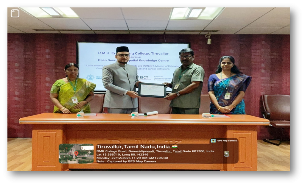
The Open Source Geospatial Knowledge Centre (OSGKC) at the Department of Civil Engineering, R.M.K. Engineering College (RMKEC) has been established in line with the existing Centre of Excellence on GIS and Smart Cities. The centre operates in collaboration with FOSSEE GIS, IIT Bombay, under the National Mission on Education through ICT (NMEICT) initiative of the Ministry of Education, Government of India.
The centre was formally recognized and inaugurated on 22 December 2025 by Mr. Mohamed Kasim Khan, National Coordinator – FOSSEE GIS Project, IIT Bombay. The initiative aims to promote the adoption of open-source geospatial technologies in education, research, and real-world applications, thereby strengthening the capabilities of students and faculty in the domains of GIS, Remote Sensing, and spatial analytics.
The initiative aims to promote the adoption of open-source geospatial technologies in education, research, and industry applications. The centre focuses on building technical competency among students and faculty in areas such as GIS, Remote Sensing, spatial analytics, and digital twin technologies. The Department of Civil Engineering has established a state-of-the-art GIS laboratory to support the OSGKC initiative.
Through OSGKC, Department of Civil Engineering RMKEC has become a district hub for capacity building, collaborative research, and innovation in open geospatial technologies aligned with SDG 4 – Quality Education, SDG 9 – Industry, Innovation and Infrastructure, SDG 11 – Sustainable Cities and Communities, SDG 17 – Partnerships for the Goals.
Objectives
The Open Source Geospatial Knowledge Centre aims to:
- Promote the use of open-source GIS technologies in academia and industry.
- Train students and faculty in modern geospatial tools and spatial analytics.
- Support research and innovation in GIS, Remote Sensing and GeoAI.
- Encourage student internships and collaborative development projects.
- Facilitate workshops, webinars, and faculty development programs in geospatial technologies.
- Contribute towards sustainable development through geospatial applications
2022- 26 Batch – 12 students
2023 – 27 Batch – 13 students
Through these internships, students gain hands-on experience in:
- Open-source GIS tools
- Spatial data analysis
- GIS software customization
- Collaborative geospatial development projects
- Research-oriented GIS applications
These internships provide students with valuable exposure to real-world geospatial problem solving and open-source software development ecosystems.
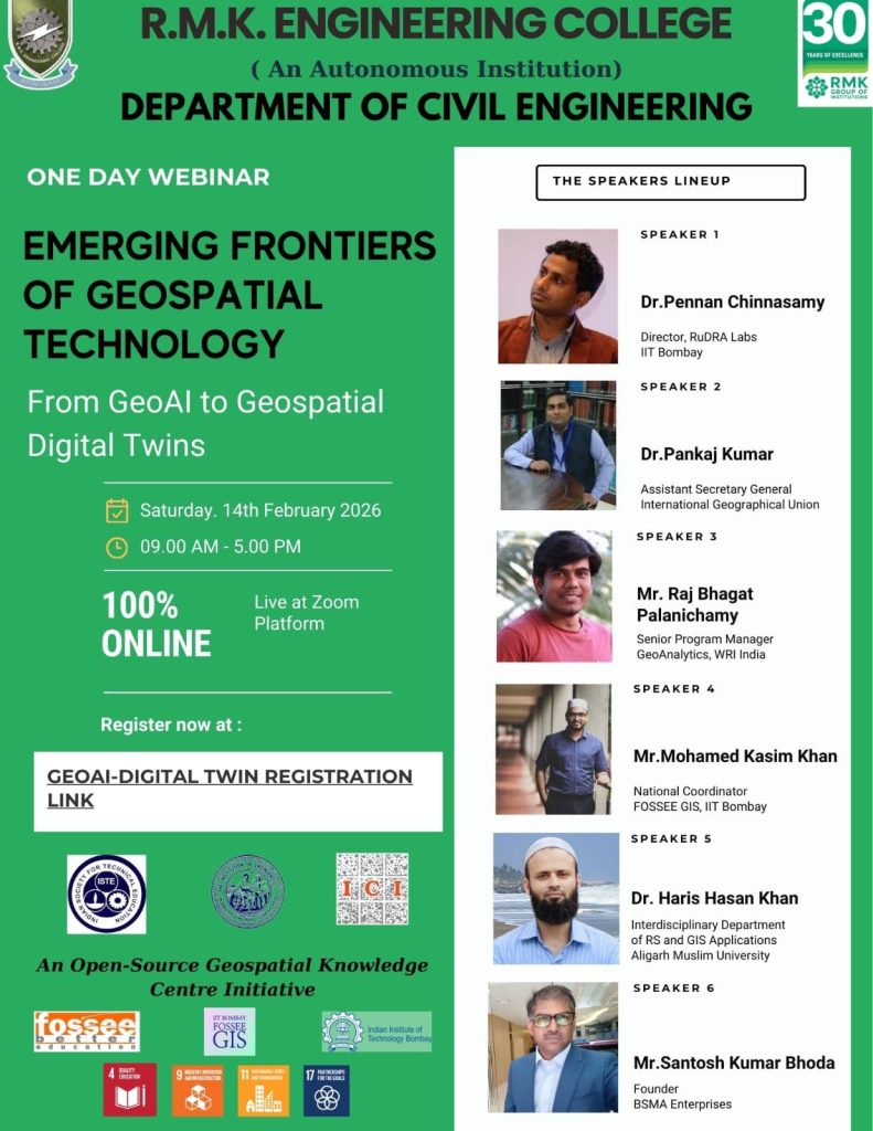
International Webinar on “Emerging Frontiers of Geospatial Technology – From GeoAI to Geospatial Digital Twins”
Distinguished Speakers
Dr. Haris Hasan Khan
Interdisciplinary Department of RS and GIS Applications
Aligarh Muslim University
Topic: Geospatial Digital Twins for Water Resources Management
Mr. Raj Bhagat Palanichamy
Senior Program Manager – GeoAnalytics
World Resources Institute (WRI) India
Topic: Digital Twins and its Needs
Mr. Santosh Kumar Bhoda
Founder, BSMA Enterprises
Topic: From Drawings to Living Assets: Understanding Geospatial Digital Twins in Civil Engineering
Dr. Pennan Chinnasamy
Director, RuDRA Labs, IIT Bombay
Topic: GeoAI for Rural Development
Mr. Mohamed Kasim Khan
National Coordinator, FOSSEE GIS – IIT Bombay
Topic: AI for Education and ResearchMs. Madhulika Goyal
Senior Program Manager, FOSSEE – IIT Bombay
